GIS - Urban Development Authority
URBAN DEVELOPMENT AUTHORITY (GIS) CENTER
Our GIS Centre located at 7th Floor of the ‘Sethsiripaya’ Building at Battaramulla Srilanka consists of a
a) Main GIS Centre and
b) User Centre.
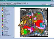
The scope of the centre is to provide digital data required for planning and management of urban areas by applying latest technologies and automation of its planning process by developing Integrated Urban GIS Databases. The functions of the centre is three fold:
a) Geographic Information System applications
b) Remote Sensing applications
c) Global Positioning System applications
The main activities of the UDA (GIS) Centre
::: Development of site selection criteria for different activities connected with action project.
::: Establishment of a National Net and Development of comprehensive Integrated National GIS Database at Grama Niladhari Divisions.
::: Develop the necessary procedures required for the image processing functions connected with Quick Bird, IKONOS,IRS,SPOT and any other satellite images.
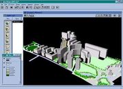
::: Develop and customize the already developed software packages for local authorities who are interesting in e_planning concept and planning approval & clearance systems.
::: All ending user requests
What is (GIS)?
A geographic information system is a system for management, analysis, and display of geographic knowledge, which is represented using a series of information sets. • Maps and Globes
• Geographic Data Sets
• Processing and Work Flow Models
• Data Models
• Metadata
GIS is evolving from a database approach to a knowledge approach UDA has a Fiber Optic, 50 user license Network which runs on a windows NT Server platform. It has been build on client/Sever architecture. It runs through 6th and 7th floors connecting all the divisions /Units of the UDA
Avalabale Digital Map Base
- Scanned & Geo-referenced 1:50,000 Maps
- Scanned & Geo-referenced 1:100,000 Maps
- Scanned & Geo-referenced 1:63,360 Maps
- Digital Layer of 1:250,000 Maps
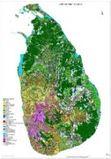
- Land Use Map of Sri Lanka Based on 1:50,000 Maps
- Road Network Map of Sri Lanka Based on 1:50,000 Maps
- Avalabale Ikonos satalite images of Sri Lanka
- Ikonos Images of post Tsunami Coverage
Anual Work Programm
A. Data Base Development for UDA Planning
B. Data base Development for Lands and Property
Management Division
C. Development and Documentation of Procedures
D.Facilitate to conduct research studies
E. Implementation of decisions of Permanent
Committee on Infrastructure Development
Coordination
F. Publication of GIS Newsletter
E.Training Programmes
Insert Another Sub Header Here
URBAN e-NET is a system to allow the submission of Development Applications electronically to UDA for planning clearance and approval. The system would develop to allow any developer with access to the internet to make submissions of Development Application from the convenience of their offices or homes.
Establishment of Urban e-Net is the first step towards the concept of One Stop Submission System to be developed by UDA, witch will integrate manual submission process with electronic submission processes with the use of electronic plans, This system would facilitate about 15-20 percent of Development Applications coming to UDA.


